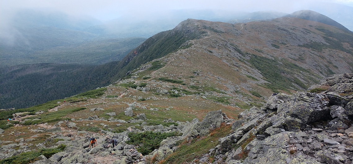

Looking south from the flank of Monroe towards Eisenhower
Photo: Ben Leoni
BY Ben Leoni
After scrambling across a cloud enveloped ridgeline for nearly four hours, the scene at the top of Mount Washington of a hundred tourists shivering in sweatshirts, and the smell of cigar smoke, the the low hum of idling cars nearly sent me into a panic. “Dude, we got to get out of here,” I told Ari. Ari’s eyes widened as we came into view of the summit. “There are like a hundred people waiting to take their photo with the summit sign,” he said as he shook his head. “This place is nuts.”
Ari and I were smack dab in the middle of one of the most popular trail runs in the Northeast: the Presidential Traverse. The “Prezi” Traverse is a 19-mile route across the highest ridgeline in New Hampshire. Starting with a 4,000 vertical climb up Mount Madison and Mount Adams in the north, the route then meanders south across Mounts Jefferson, Clay, Washington, Monroe, Franklin, Eisenhower, and Pierce before descending to Crawford Notch. That’s roughly 11 miles of above-treeline exposure in a range known to have some of the world’s worst weather.
For nearly a century, Mount Washington’s claim to fame was the highest recorded surface wind speed on earth. And with close to 9,000 vertical of climbing, nearly half of which occurs in the first 4 miles, the Prezi traverse definitely a quad burner. Yet locals can attest to the fact that these factors strangely constitute some of the Prezi traverse’s biggest attractions. The Mount Washington Valley boasts a robust and competitive trail running scene. Several well-known routes, such as the Prezi traverse and the 32-mile Pemigewasset loop, attract professional trail runners from near and far.
Despite growing up in New Hampshire and working for years in backcountry huts perched high in these mountains a decade ago for the Appalachian Mountain Club, I had never actually attempted a Prezi traverse before. I had to change that. And for some reason, I chose Labor Day Weekend, one of the busiest times of the year in these mountains, to do just that.
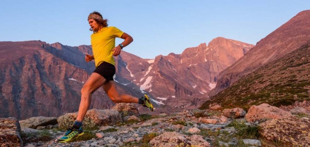
Let’s get one thing straight—I am not a “trail runner.” I do this stuff because I love the mountains and because it’s a fun way to train for my winter backcountry skiing adventures. Yet the Appalachian Mountain Club huts, whose seasonal employees are known as “hut croo,” have indeed produced some of the fastest trail runners in the world over the past decade. Take, for example my hut croo contemporary, Hilary Gerardi, a Scarpa athlete now living in the Alps who just became the SkyExtra World Champion. Or Katie Schide, who finished second in this year’s CCC UTMB race in Chamonix. And there’s Tristan Williams, still living in the Mount Washington Valley, who Trail Runner Magazine deservedly crowned “The Fastest Trail Runner You’ve Never Heard Of.”
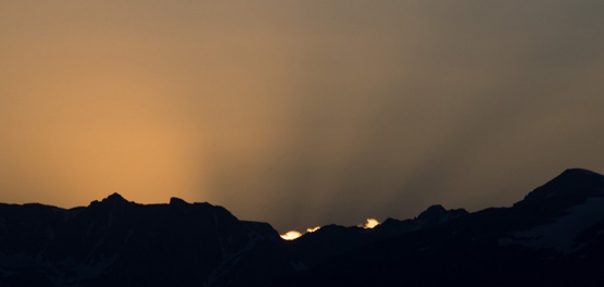
While the fastest known time for the Prezi traverse is a mind-boggling four hours and nine minutes, I was just hoping to break eight and a half hours. As we approached the trailhead that morning, we could see the summit of Mount Madison poking through scattered clouds and orange highlights from the rising sun. The weather report for that day looked great. Mostly sunny with a high in the upper 50’s on the summits. Perfecto.
I was joined that morning by Ari Ofsevit, another former hut croo who possesses far more talent scampering across mountains than I do. We left the trailhead at about 6:30 AM, chatty and optimistic that our day would be full of jaw-dropping views.
But mother nature, who gets particularly fussy in the Prezis, had other plans. As we climbed toward Madison, the trees dripped water from the prior day’s rain and we quickly found ourselves slipping on greasy wet rocks. There are no switchbacks in NH. Straight up is the only way up and by the time we hit treeline, a mile from our first summit, the cloud cover had begun to wrap the summits in a thick grey sweater. We quickly bagged Madison in the fog after climbing over 4,000 vertical feet in a little more than four miles. Dropping back below the cloud ceiling, we cruised past Starr Lake, a beautiful alpine pond surrounded by golden alpine grasses and blueberry bushes, before ascending Mount Adams.
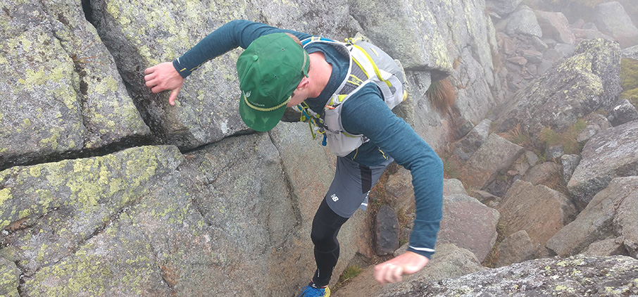
To be honest, there wasn’t a lot to see for the next five miles thanks to the blowing fog. The northern Prezis are covered with sharp granite boulders that demand strong focus with each step, especially when wet. It’s not so much trail running as some sort of weird drunken ballet skip across sharp tips of rock, all while keeping your hands out to catch your body during the inevitable wipeout. Instead of going up and down the rocks with the trail, you kind of skip across the top of them, waist-high above the ground. By the time we had passed over Adams, Jefferson, and Clay, my hand was bleeding from a crash and I was soaked from the occasional drizzle and wind driven fog. I had put on every layer I had with me, including my decidedly unattractive running tights under my shorts. I looked over at Ari and despite the conditions, saw that he was grinning too.
There is a strange sense of isolation and peacefulness that one gets when scampering across weathered foggy peaks without seeing any sign of civilization short of the 15 yards of trail in front of you. My mind wandered through this strange playground of granite and mist as my body skipped along on auto pilot. I passed familiar entrance points along Great Gulf to some of the best backcountry skiing chutes in New England. I could visualize the drop in and feel the first puckering turn as the ski flexed and propelled me down the fall line. This was just the motivation I needed for our push to the summit of Mount Washington.
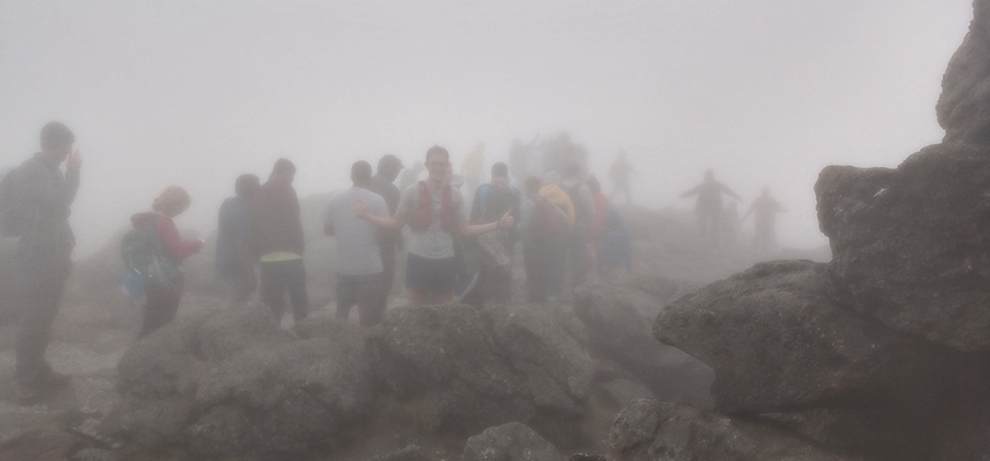
There, the scene shook the tranquility from us as violently as a train wreck. Hundreds of tourists, who had just hopped off the historic Cog Railway, or had just stepped out of their warm cars after ascending the auto road to the summit, were lining up to take their photo on the summit.
The noise, sights, and smells from the scene quickly forced us south in a panicked retreat toward Mount Monroe. Just before coming to Lakes of the Clouds, we broke through the summit fog and froze in our tracks. The sublime view of high alpine lakes perched above the sun-bleached valleys below stretched before us—our first view in nearly 6 miles. We made our way quickly to the Appalachian Mountain Club’s Lake of the Clouds Hut and slurped down a bowl of minestrone soup cooked by the current hut croo before poking back up into the mist and over Mount Monroe.
This is where the Prezi traverse gets genuinely fun. The trail, while still rocky, becomes much smoother and we began to leave footprints in dirt for the first time. Though we still had a few peaks to climb, the rest of the trail was mostly downhill, smooth, and, most importantly, below the clouds. We floated along reddish-brown cliffs stretching into the sky above the green of the Dry River Wilderness valley below.
It felt like we were flying as we passed group after group of hikers, including two other trail runners who were also on their way to completing a Prezi traverse. I tripped and crashed again, only because I was too enamored with the views to look where I was going. After huffing it over Eisenhower and Pierce, we dropped back into the trees for the first time in roughly 12 miles.
I recall thinking just how green everything seemed in the moss-covered forests of balsam fir and red spruce.
We emerged from the forest at Crawford Notch and collapsed into the warmth of grass that had been baked under the high afternoon sun. We’d finished the 19-mile traverse in about seven and a half hours. No freaking FKT but good enough for me. As I basked in the sun and listened to the drone of cars full of tourists buzz past me, I was already planning next year’s return.
Ascending Mount Adams from Starr Lake
Photo: Ben Leoni

Star Lake Berries
Photo: Ben Leoni
Tourists lined up to take their photo on the top of Mount Washington
Photo: Ben Leoni
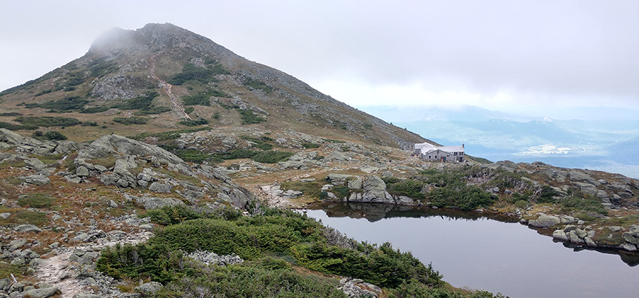
View of Lake of the Clouds with the hut visible above the Mount Washington Valley below
Photo: Ben Leoni
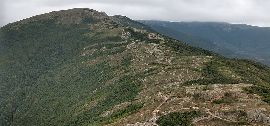
Looking back towards Eisenhower from Pierce.
Photo: Ben Leoni

Descending back into the green tunnel of fir and spruce.
Photo: Ben Leoni
Featured Product

Related Stories